
Work in progress

Deep maps are finely detailed, multimedia depictions of a place and the people, buildings, objects, flora, and fauna that exist within it and which are inseparable from the activities of everyday life. These depictions may encompass the beliefs, desires, hopes, and fears of residents and help show what ties one place to another. A deep map is a way to engage evidence within its spatio-temporal context and to provide a platform for a spatially-embedded argument. The essays in this book investigate deep mapping and the spatial narratives that stem from it. The authors come from a variety of disciplines: history, religious studies, geography and geographic information science, and computer science. Each applies the concepts of space, time, and place to problems central to an understanding of society and culture, employing deep maps to reveal the confluence of actions and evidence and to trace paths of intellectual exploration by making use of a new creative space that is visual, structurally open, multi-media, and multi-layered.

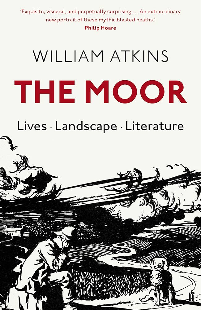
In this journey across England’s most forbidding and mysterious terrain, William Atkins takes the reader from south to north, exploring moorland’s uniquely captivating position in our history, literature and psyche. Atkins’ journey is full of encounters, busy with the voices of the moors, past and present. He shows us that, while the fierce terrains we associate with Wuthering Heights and The Hound of the Baskervilles are very human landscapes, the moors remain daunting and defiant, standing steadfast against the passage of time.
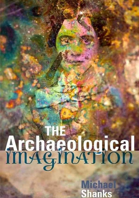
In his book Shanks offers the following definition: “To recreate the world behind the ruins on the land, to reanimate the people behind the shard of antique pottery, a fragment of the past: this is the work of the archaeological imagination, a creative impulse and faculty at the heart of archaeology, but also embedded in many cultural dispositions, discourses and institutions commonly associated with modernity. The archaeological imagination is rooted in a sensibility, a pervasive set of attitudes toward traces and remains, towards memory, time and temporality, the fabric of history.” pp.25
Text reproduced from https://www.google.co.uk/books/edition/The_Archaeological_Imagination/a6tJDAAAQBAJ?hl=en&gbpv=0 (accessed 13/08/23)
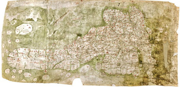
“The printer and publisher John Nichols described Richard Gough in a long tribute after his death as ‘the Father of British Topography’. More recently scholars have recognised him as the leading antiquary of his day. Gough was one of the first to recognise the importance of old maps in helping to understand the history of particular places and wrote a pioneering account of the development of British maps in the second edition of his British Topography (1780). This is the oldest map of Britain at the Bodleian Library, Oxfordshire (exact date unknown, approx. 14th Century). In addition, the topographical collection bequeathed by Gough to Oxford University in 1809 is one of the most important in the Bodleian Library, outstanding for the visual material received as well as the printed books and manuscripts. Among the maps is the earliest depiction of Britain in recognisable form (now known as the Gough Map) and large portions of the unique Sheldon tapestry map woven in the 1590s.
His Anecdotes of British Topography (1768) was the first comprehensive national bibliography of the subject and a remarkable achievement for one individual. It provided a gazetteer of sources relating to the local history and antiquities of each county, covering not just printed books and manuscripts but also maps and illustrations often with comments about dates, artists and when he acquired items. An enlarged second edition in two volumes was published in 1780 under the title of British Topography. Gough was one of the first to recognise the importance of old maps in helping to understand the history of particular places and wrote a pioneering account of the development of British maps in the second edition of his British Topography (1780).”
Text and image reproduced from https://www.bl.uk/picturing-places/articles/richard-gough-the-father-of-british-topography (accessed 21/07/23)
References for further research:
1] Richard Gough, British Topography. Or, an Historical Account of what has been done for Illustrating the Topographical Antiquities of Great Britain and Ireland, London, J. Nichols and T. Payne, 1780. The completed part of the 3rd edition was destroyed in 1808 by a fire in Nichol’s printing works. However the Bodleian has a copy of the 2nd edition with useful later additions by Gough (Gough Gen.Top. 363–5).
2] Peter Barber, ‘King George III’s topographical collection: a Georgian view of Britain and the world’, in Kim Sloan and Andrew Burnett (eds), Enlightenment: Discovering the World in the Eighteenth Century, London, British Museum, 2003, pp. 158–65.
3] The most useful guide to Gough’s topographical drawings is Maurice Barley, A Guide to British Topographical Collections, [London], Council for British Archaeology, 1974, pp. 95–8.
