Paper 9: Michael Drayton’s Topographies: Ideas Mirrour (1594) and Poly-Olbion (1612-1622), María Vera-Reyes

Poly-Olbion frontispiece

INTRODUCTION:

The purpose of this article is a comparative analysis of Drayton’s poems Ideas Mirrour and Poly-Olbion tracing echoes of the former in his latter richly chorographical work. For the purpose of this analysis the main focus is on Poly-Olbion as a prime exemplar of a chorographic work and I also aim to draw out strands that specifically follow the concept of the body as it pertains to one of my research questions: If a sensory physical mapping of place occurs prior to representation where is the body in the process of chorography and how do we address the political implications of the embodied in the act of representation? It appears this question is complex as bodies often appear symbolically in rich and intricate intertextual and iconotextual relationships. The body it seems emerges as a chimera hiding in plain sight like Poe’s purloined letter. A chorographic text such as Poly-Olbion offers tangible clues as to how this problematic might be addressed through practice.

POLY-OLBION (1612-1622):

Poly-Olbion is an expansive poetic journey through the landscape, history, traditions and customs of early modern England and Wales. Originally published in two parts (1612, 1622), it is also a richly collaborative work: Michael Drayton’s 15,000-line poem navigates the nation county by county and is embellished by William Hole’s thirty engraved county maps. It is accompanied for its first eighteen ‘songs’ by John Selden’s prose illustrations. Drayton was a contemporary of Shakespeare and Ben Jonson, and Poly-Olbion crystallizes early modern ideas of nationalism, history and memory.

Drayton’s Early Sonnets, Poly-Olbion and Chorography:

Reyes outlines how Drayton’s epic Poly-Olbion was influenced and connected to his earlier sonnets particularly Ideas Mirrour (1594) later published as Idea (1599-1631) which both reflect and explore his interest in the history and topography of his country and celebrate ‘the discovery of England.p.1002The central trope in the allegorical Idea is fluvial and Drayton draws on ‘chorographic techniques to represent the beloved.’ p.1003 The central figure Idea, as an ideal representation of woman contained within the ideal geography of the English landscape, is embedded in the River Anker which runs through Drayton’s home county of Warwickshire and later appears in Poly-Olbion ‘where the poet finds the woman that he had originally praised under the poetic name of Idea.’p.1014

In Poly-Olbion Reyes identifies close connections to distant genres including sonnet, sequence, perspective, pastoral, epic, the heroic, lyrical and topographical as Poly-Olbion comes to represent the ‘eroticisation of the landscape’. whilst simultaneously trying to reify Drayton’s English identity. p.1003 Developments at the time facilitated this vision in the ‘revival of geographical writings and advancements in cartography’ and the renaissance of chorographic works in the 16th-17th Centuries, the most notable exemplar of the genre being William Camden’s Brittania (1586) pp.1003-4. Other proponents of the descriptive and primarily textual approach to history and travel narrative included the antiquarian works of John Leland’s Itinerary (1549) and William Lambarde’s A perambulation of Kent (1576). The rise of the ‘body politic’ and the ‘vision of the allegorical body’ supported ‘a spatial construction of national identity.’ p.1004 The rediscovery of Strabo and Ptolemy presupposed the encyclopedist approach to the genre but one whose methodologies ‘favoured a qualitative and localist point of view with a pictorial quality.’  P.1004

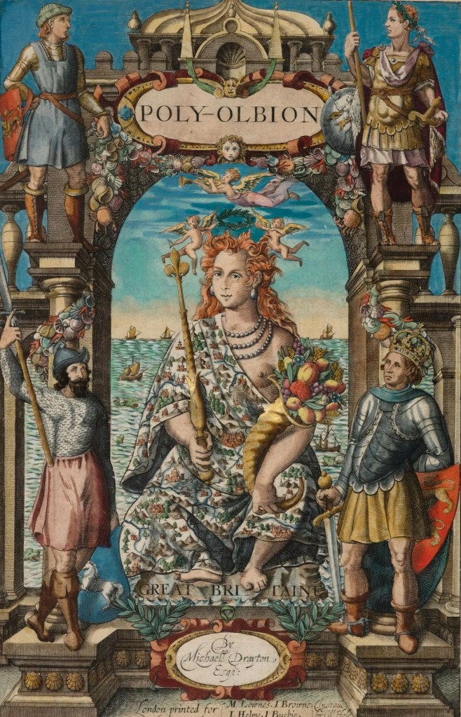
Reyes states that ‘Drayton’s interest in topography and the human body was driven by the Golden age of cosmography and cartography in England […] and reflected the idea of a human being as a microcosmos.’ p..1006 According to D K Smith (XXXX no date given) in the 16th-17th Centuries this ‘resulted in a new cartographical epistemology and a cartographic imagination that provided English authors with a new set of metaphors and rhetorical tropes related to space and it’s embodiment.’ P.1006 Reyes states ‘the conception of the body as space determined the aesthetics of Poly-Olbion’. She cites Traub (XXXX no date given) ‘the description of human figures became a common aesthetic in Renaissance cartographies – ‘maps began to imply that bodies may be a terrain to be charted and is responsible for the chorographic function of human figures.’ P.1006 The ‘representation of the human body came to be seen as a ‘conglomerate of delimited spaces’. P1006 According to Reyes this explains the ‘anthropomorphizing representations of rivers, hills, mountains and forests’ in the maps of Poly-Olbion and that this representation of space is commensurate with a topographical representation of the body. P.1006 Between Ideas Mirrour and Poly-Olbion there is a ‘reciprocal movement from the topographical representation of the human body and the personification of the landscape’. P.1006. This personification of the landscape is represented in the above engraving, the frontispiece to Poly-Olbion which Helgerson (XXXX no date given) states is ‘a goddess like woman dressed in a map’ holding the horn of plenty, which symbolizes prosperity, and who stands as ‘a living embodiment of nature.’ P.1010
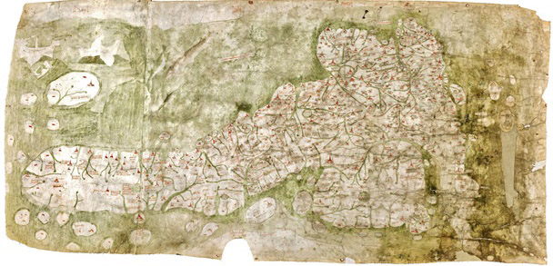
Map of Yorkshire, England, 1622 from Poly-Olbion

Fig.1

Image reproduced from https://www.walesonline.co.uk/news/wales-news/trend-grown-up-colouring-been-11487014 (accessed 06/02/24)
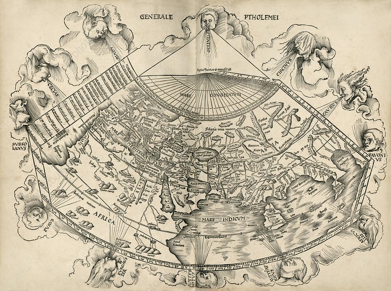
Fig.2

https://fineartamerica.com/featured/poly-olbion-map-of-yorkshire-england-1622-michael-drayton.html (accessed 07/02/24)

The Gough Map

The Gough Map

“The printer and publisher John Nichols described Richard Gough in a long tribute after his death as ‘the Father of British Topography’. More recently scholars have recognised him as the leading antiquary of his day. Gough was one of the first to recognise the importance of old maps in helping to understand the history of particular places and wrote a pioneering account of the development of British maps in the second edition of his British Topography (1780). This is the oldest map of Britain at the Bodleian Library, Oxfordshire (exact date unknown, approx. 14th Century). In addition, the topographical collection bequeathed by Gough to Oxford University in 1809 is one of the most important in the Bodleian Library, outstanding for the visual material received as well as the printed books and manuscripts. Among the maps is the earliest depiction of Britain in recognisable form (now known as the Gough Map) and large portions of the unique Sheldon tapestry map woven in the 1590s.

His Anecdotes of British Topography (1768) was the first comprehensive national bibliography of the subject and a remarkable achievement for one individual. It provided a gazetteer of sources relating to the local history and antiquities of each county, covering not just printed books and manuscripts but also maps and illustrations often with comments about dates, artists and when he acquired items. An enlarged second edition in two volumes was published in 1780 under the title of British Topography. Gough was one of the first to recognise the importance of old maps in helping to understand the history of particular places and wrote a pioneering account of the development of British maps in the second edition of his British Topography (1780).”

Text and image reproduced from https://www.bl.uk/picturing-places/articles/richard-gough-the-father-of-british-topography (accessed 21/07/23)

References for further research:

1] Richard Gough, British Topography. Or, an Historical Account of what has been done for Illustrating the Topographical Antiquities of Great Britain and Ireland, London, J. Nichols and T. Payne, 1780. The completed part of the 3rd edition was destroyed in 1808 by a fire in Nichol’s printing works. However the Bodleian has a copy of the 2nd edition with useful later additions by Gough (Gough Gen.Top. 363–5).

2] Peter Barber, ‘King George III’s topographical collection: a Georgian view of Britain and the world’, in Kim Sloan and Andrew Burnett (eds), Enlightenment: Discovering the World in the Eighteenth Century, London, British Museum, 2003, pp. 158–65.

 3] The most useful guide to Gough’s topographical drawings is Maurice Barley, A Guide to British Topographical Collections, [London], Council for British Archaeology, 1974, pp. 95–8.

Micro Critique Paper No.4

Introduction: Analysis of the following articles have revealed problems in defining the field of chorography as well as methods, theories and insights which warrant further examination. These summaries identify, illuminate and reflect on these issues and their implications in theory and practice.

Paper 4: Curry, M. (2005) “Toward A Geography of a World Without Maps: Lessons From Ptolemy And Postal Codes”. Annals of the Association of American Geographers [online] 95 (3), 680-691. Available from http://onlinelibrary.wiley.com/doi/10.1111/j.1467-8306.2005.00481.x/abstract [5th October 2015]

Ptolemy’s world map. This map of the world is from an edition of Ptolemy’s ‘Geographia’, published in 1513 by German cartographer Martin Waldseemuller (c.1470-1520)

Curry’s paper is concerned with the conflation of place and space in contemporary discourse which commonly obfuscate and erase their differences. His primary aim is to elaborate upon the terms chorography, topography and geography and delineate their differences by examining their ‘technologies and practices’. He suggests chorography is limited to the geographer’s knowledge, clearly in the context of this research this is not the case and in his own words ‘it is alive and well.’ Curry argues these geographic ways of knowing each have their own objects of study; region, place and the earth’s surface.  He is critical of both their neglect in discussions of place or analyses which focus on scale in relation to these concepts as opposed to form and function. Curry employs a complex analogy of the invention of the US ZIP code to illuminate his argument.

Curry compares and contrasts these terms by tracing and re-interpreting their origins to distinguish them from contemporary understandings. He locates chorography and topography within foundational concepts of place and memory. Chorography was a qualitative way of interpreting the world, both celestial and terrestrial, and this knowledge was located in ‘signs or symbols’ which aimed to perceive relations ‘between events, places and the times of their occurrence’.  He relocates topography’s association with mapping by placing it in the oral tradition and the ‘art of memory’. In this context places are created, narrated, performed and re-formed through symbolic associations. Place and experience are coextensive with each other and this element of the mnemonic has already been established independently in prior research.

For Curry the importance of this argument is not simply a matter of different scales of apprehension, but more significantly is intrinsically linked to repositories of knowledge, dissemination and retrieval. He argues space was ‘invented’ against the backdrop of place, due to emergent technologies necessitated by an increase in information, leading to an erasure of the chorographic and topographic by the geographic. Chorography and topography represent human patterns of knowing and belonging in contrast to the panoptic vision of geography. The implications of this observation equate to an erasure of memory practices and a movement from an embodied and emplaced performance of knowledge to its commodification. Places are increasingly mediated by technology and this also applies to the digital records of archaeological fieldwork. For instance when I was introduced to archaeological fieldwork at Erddig, Wales the corresponding planar database managed by the Historic Buildings, Sites and Monuments Record comprises 24 topographic views of each location in the field; a complex palimpsest inconceivable in a single view. This centralization of information which allows for the preservation of heritage data becomes an abstracted space of typology and categorization devoid of the people that inhabited them or the places that created them.

Curry’s analogy of the standardisation of the ZIP code can, in the context of this paper, be equated with geography reaching its empirical, scientific, mathematical and spatial exactitude in the art of cartography. This organisation of geographical knowledge, in the case of the ZIP code, privileges spatial points and co-ordinates whereby the particularities of place, regions, difference, the local and thus topography and chorography are subsumed and erased by spatial systematisation, the realm of demographics and the global organisation of information.

Image reproduced from https://www.sciencephoto.com/media/428654/view/ptolemy-s-world-map-16th-century (accessed 03/11/22)

Micro Critique Paper No.2

Introduction: Analysis of the following articles have revealed problems in defining the field of chorography as well as methods, theories and insights which warrant further examination. These summaries identify, illuminate and reflect on these issues and their implications in theory and practice.

Paper 2: Shanks, M. and Witmore, C. (2010) “Echoes across the Past: Chorography and topography in antiquarian engagements with place”. Performance Research 15 (4), 97-106.

William Gell, Study of a lekythos (Notebook 1, GELL 4534b)

The aim of this paper is to elucidate chorographic and topographic methods in various strands of Antiquarian practice. Shanks and Witmore identify common components of Antiquarianism including local and national history, geography, the regional, examination of archaeological remains and the act of collecting. Although chorography is pre-disciplinary they claim a genetic link forms the basis of contemporary disciplinary approaches across heritage management, tourism, archaeology, historical geography and contemporary arts practice. They argue for a genealogical understanding of inter or trans-disciplinary practices concerned with relations of land, place, and locational identity to provide an enhanced understanding of present disciplinary, practical and academic positions. They substantiate these claims by drawing parallels between 16th-19thC Antiquarian practice concerned with “the history and geography of regional landscapes and the management and collection of archaeological artefacts […] seeking tangible historical roots and emerging nation states of modernity” and “contemporary global engagements with land and senses of place” of which they argue Antiquarianism is the main foundation. pp.97

Shanks and Witmore explore three primary components of Antiquarian practice including ‘chorography, itinerary and topography’ in part by way of the Scottish Borders. Their succinct, though unexpanded, definition is etymologically uncomplicated and more closely reflects my own understanding of chorography as ‘the documentation of region’. This practice includes the act of journeying and movement (itinerary) and the intersection of past and present in relation to the landscape (topography). They utilise the concept of performance and the performative to lever open unresolved issues at the heart of antiquarian practice including ‘tensions of property, belonging and ownership, anxieties about scientific and literary authenticity and social responsibility’ which warrants further analysis, pp.97

Through a close reading of Antiquarian texts, the authors perform a comparative analysis of works by William Gell, Martin Leake and the ‘literary antiquarian’ Walter Scott. They contrast their methods, attitudes in practice and also what unites them; a quest for the authentic, the fragment, the quotidian, elevating the historical detail to the status of epic. Although there are crucial distinctions to how this process is performed and manifested the authors draw attention to the implications of representation beyond the idea of medium as a means to an end i.e. the ethics and politics of representation and speaking authentically for others. These concerns are redolent of a distinct strand of Critical Ethnography under consideration for this research.

The lay of the last minstrel – by Sir Walter Scott, Illustrated by James Henry Nixon

Their analysis shows Gell and Leake take a scholarly, rational and distanced stance which is measurable, cartographic, precise, descriptive and forensic in attitude. The implications of placing Scott in the chorographic canon is an emphasis on oratory, the art of memory, folk-lore and the vernacular Ballad. Scott is not simply a collector for the sake of historic facts in and of themselves nor is he concerned with a distanced antiquarian, empirical exactitude of observation and precise recording. Scott’s literary, discursive and interpretative mode becomes an act of re-collection, re-writing, re-telling and re-presenting. Scott performs a curatorial act, a selective re-framing which recuperates, conserves, transforms and embellishes. In the case of The Lay of the Last Minstrel 1805, set in the middle of the 16th century, occupying Three Nights and Three Days, the poem articulates the manners and customs of the English/Scottish borders through the ‘narrator’, an ancient Minstrel. Throughout this process Scott’s voice is ventriloquized and dispersed into the collective voice of the ballad, the polyvocal, polyphonic and polyvalent, a performative co-mingling that results in a complex intertextual topography. Shanks and Witmore argue the topical qualities of Scott’s work place him in the tradition. These topics include “landscape and manners, terrain, tradition, scenario and narrative fragment, names and lists, genealogies and toponymies.” pp. 100 Shanks states these features are central to the antiquarian genre of chorography. Scott’s narrative poems and novels setting tales in the distant and not so distant past did much to foster people’s interest in history. Scott was involved in historical study and gained a reputation as an antiquary and practised amateur archaeology. There is no evidence to suggest however that he equated his work with chorography although he may have been familiar with the term. [1]

These contrasting approaches warrant further investigation regarding their significance to this research. According to the authors Scott’s work exceeds the concept of mimesis as representation due to it’s complex construction and fabrication. Prior research has identified this is an important factor to how alternative mimetic theoretical models might inform the study. My MA Thesis, Ariadne’s Dance Floor, Choragraphy and the Ecstatic Subject, (Distinction) Royal College of Art 2013 sought to restore a connection to the philosophical roots of mimesis and to the feminine and dance. The title was not a playful affectation but a statement of political intent via the deliberate spelling of chorography as choragraphy following the work of geographer Inger Birkeland and Julia Kristeva. According to Perez-Gomez [2008] mimesis was not originally connected to imitation “but the expression of feelings and experience through movement, musical harmonies and rhythms of speech.” [2] This underscores one of my own concerns and the need to make a distinction between the performative, embodied act and its subsequent re-presentation, this perceived gap would clarify chorography as both process and product. My concern is an overt emphasis on chorography as representation; as visual medium as opposed to embodied method. Shanks and Whitmore conclude with the idea that insights into the ‘antiquarian genre of chorography’ could provide sound methodological principles for addressing critical epistemological issues, institutional or otherwise, of conducting research.

[1] Making History: Antiquaries in Britain, 1707-2007. (2007). United Kingdom: Harry N. Abrams. pp.170 Image reproduced from https://www.bsa.ac.uk/2020/11/04/the-william-gell-notebooks-at-the-bsa/ (accessed 03/11/22)

[2] Alberto Pérez-Gómez, Built upon Love, Architectural longing after ethics and aesthetics, (Cambridge, MA: Massachusetts Institute of Technology, 2006), p.48.  

Images reproduced from https://www.bsa.ac.uk/2020/11/04/the-william-gell-notebooks-at-the-bsa/ (accessed 03/11/22) and https://en.wikipedia.org/wiki/The_Lay_of_the_Last_Minstrel (accessed 28/08/23)       

Currently Reading

“Placeways is a philosophical and historical interpretation of the experience and meaning of place. Searching for a way of knowing and living in the world that does not fragment experience or exploit the environment, E. V. Walter explores the way people in other cultures and other times have experienced place. The book develops Walter’s theory of topistics – a holistic way of grasping a place as the location of shapes, powers, feelings, and meanings. Exploring the common ground of such diverse fields as philosophy, history, urban planning, classics, cultural geography, architecture, sociology, and environmental psychology, Walter provides theoretical resources for readers who want to rescue the human environment from the loss of feeling and meaning. Walter discusses a wide variety of places, from prehistoric caves, the Australian desert, and classical Greece to medieval towns, Renaissance cities, and modern slums. He examines the changing realities of expressive space and reveals the nonrational, symbolic, and intuitive features in our experience of places – elements taken for granted by archaic peoples but discounted by modern civilization. The current crisis of environmental degredation, according to Walter, is also a crisis of places. For the first time in human history, people are systematically building meaningless places. If we are to comprehend and reverse the ruin and dislocation of our cities, we must develop another way of understanding the built environment and the natural landscape. True renewal, Walter says, will require a change in the way we structure experience and a return to an ancient paradigm for understanding both the natural land and the constructed world.”

Text and image reproduced from https://www.amazon.co.uk/Placeways-Theory-Environment-V-Walter/dp/0807842001 (accessed 01/10/22)